|
TASMANIA MAP GUIDE |
a pictorial guide to Tasmania's natural attractions |
|
|
|
 |


|
|
follow updates on
|
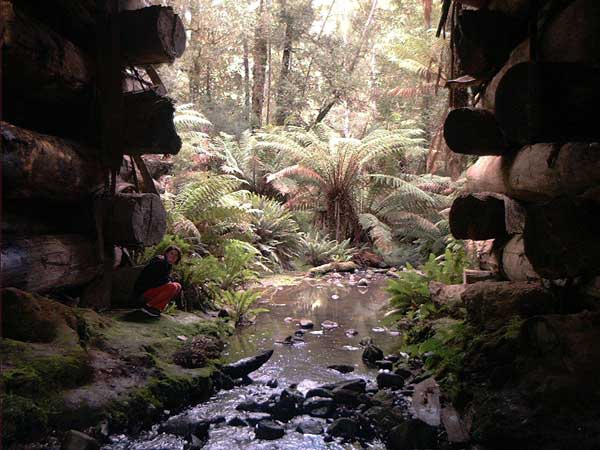
WEILANGTA FOREST DRIVE Tasman Peninsula
When driving between Port Arthur and the East Coast, the main highway heads back towards Hobart through Sorell - near Hobart. There is an alternative route between Orford and Coping along the Weilangta Forest Drive. The view above is from under Robertson's Bridge. A short 15 minute walk through the fern laden forest is worth the stop. NOTE: The bridge above has been replaced and the road now open. Checked latest conditions as this road was not well maintained (2014)
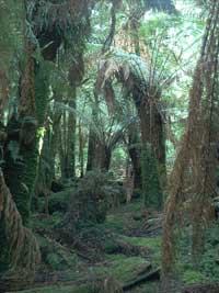
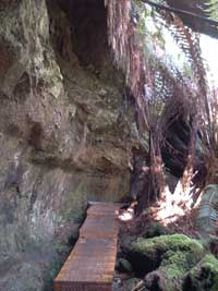
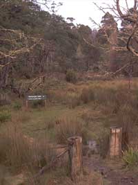
The image on the right above is at the northern end of a 1 1/2 hour walk back to the bridge. The other two are part of the short walk at the bridge.
|