Click for Full Page map

TASMANIA

MAP GUIDE

high resolution

INFORMATION INDEX
WHAT TO DO
 TOUR OPERATORS
WHERE TO STAY  
WHERE TO EAT

St Helen's towards the Bay of Fires

Home ] Up ] PORT ARTHUR HISTORIC SITE ] CAPE SURVILLE ] [ EAGLEHAWK NECK ] CAPE RAOUL ] SHIPSTERN BLUFF ] COAL MINES ] WHITE BEACH ] CAPE HUAY ] WEILANGTA FOREST ] LAGOON BEACH ] REMARKABLE CAVE ] ROARING BEACH ]

WATERFALL BAY
TASMAN ARCH
TESSELLATED PAVEMENT


NOW AVAILABLE

SLIDESHOW DVD's

SELECTED WALKS

BY REGION

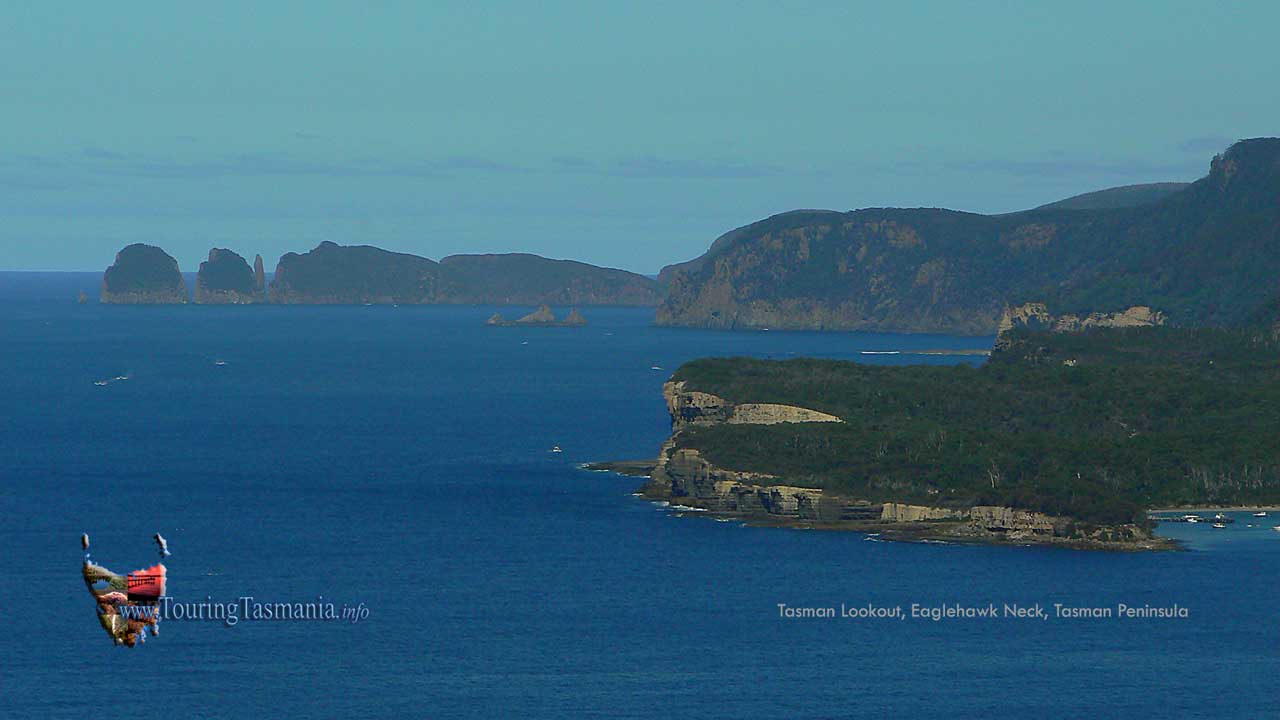
The Tasman Peninsula

EAGLEHAWK NECK
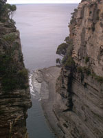
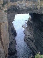
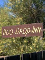
 

Eaglehawk Neck is about an hours drive from Hobart.  Just before Eaglehawk Neck there is a left turn directing visitors to a scenic route.  This is in fact the old highway into the area.  Very shortly the view of Pirates Bay on the right greets you.  Just out of the picture is a 'neck' of land a few hundred metres long and barely 50 metres wide.  Just past the neck there is a left turn leading to the features below.  The road leads right up to the cliff edge.


LEFT: Devil'sKitchen  CENTRE: Tasman Arch  RIGHT: "Doo" Town,

between the Blow Hole and Tasman Arch.


The view from the lookout at the end of the logging road high above Pirates Bay.

 At the end of the beach are possibly the most visited features on the peninsula including Tasman Arch, Devil's Kitchen and the Blowhole

all within a few hundred metres of each other.