|
PORT ARTHUR MAP
PORT ARTHUR HISTORIC SITE
EAGLEHAWK NECK
TASMAN ISLAND
CAPE HAUY
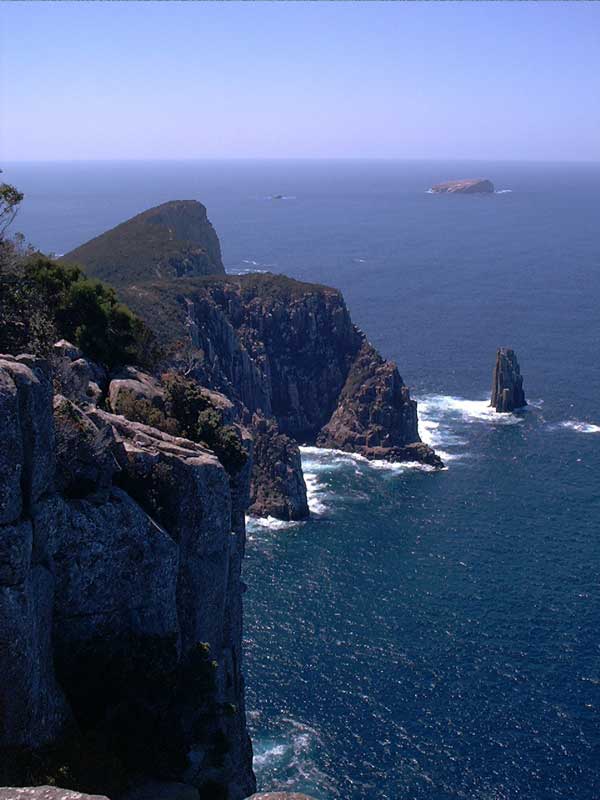
CAPE RAOUL
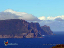
SHIPSTERN BLUFF
COAL MINES
WHITE BEACH
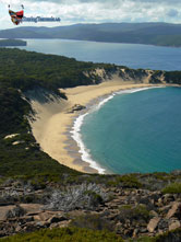
LAGOON BEACH
REMARKABLE CAVE
ROARING BEACH
CRESCENT BAY
CAPE SURVILLE
CAPE BERNIER
WIELANGTA FOREST DRIVE
|
SPONSORS
accent on
 tasmania
|
follow updates on
| |
PORT ARTHUR
& THE
TASMAN
PENINSULA
|
Port Arthur is
near the southern end of the Tasman Peninsula on Tasmania's south eastern
corner. Port Arthur is rich in history and is on the itinerary of most
visitors to Tasmania. However, there is much to explore on the peninsula. Just a few are depicted here. The Tasman Peninsula is
quite mountainous and fairly large. Most of a day would be needed to drive
around the area stopping at many of the sights. There are over 30 scenic walks from a half day and
over. We will be updating this area from time to time.
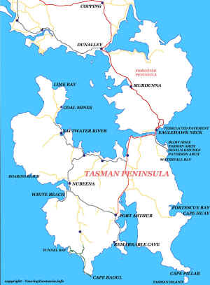
click on map below to go
to a full page map with links to locations
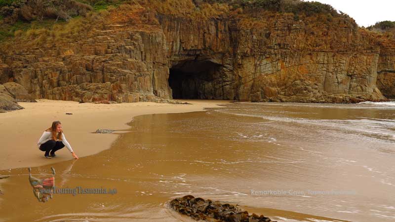
REMARKABLE CAVE |
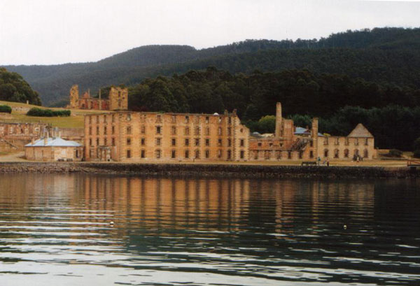
PORT ARTHUR HISTORIC SITE
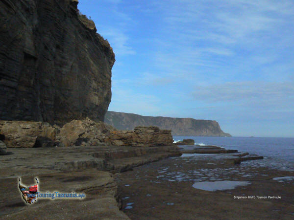
SHIPSTERN BLUFF
CAPE HAUY |
CRESCENT BAY
CAPE PILLAR
CAPE RAOUL |
|
|


