|
|
SPONSORS
accent on
 tasmania
|
follow updates on
| |
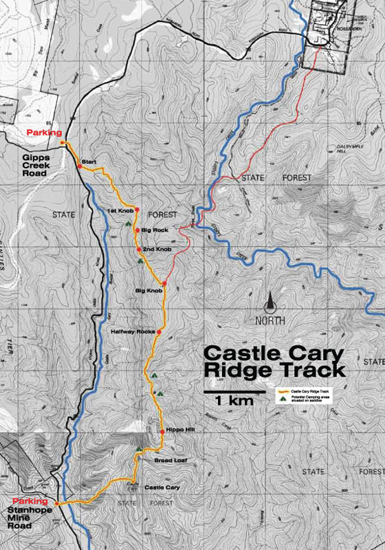
CASTLE CARY RIDGE
The Fingal Valley
 |
Castle Cary Regional Reserve lies to the
east of the road which links Avoca and Rossarden. A trail has been
marked the length of the reserve. The southern access to the walk
is at the junction with the Stanhope Mine road. The northern end
is at the Gipps Creek Road junction where the road levels off after
climbing by the ridge. See the
Fingal Valley map.
The road from Avoca is unsealed for about
2 kilometres. The rest of the road is sealed and in good
condition.
Details of the walk have been provided by
Gary Cobb who has worked on the track. More details can be found
on the Facebook page.
https://m.facebook.com/groups/1027190097321729?ref=bookmark

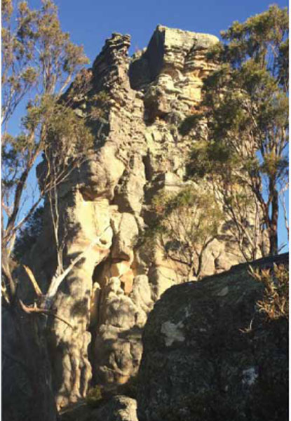
Formation known as The Bread Loaf
|
Castle Cary
|
|
|
|
 |
|
|


