|
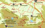
MAP - THE GREAT WESTERN TIERS
INFO WESTERN TIERS
MEANDER VALLEY
LAKE McKENZIE
LADY LAKE
MEANDER FOREST RESERVE
BASTION CASCADES
CHASM FALLS
SPLIT ROCK
SMOKO FALLS
MOTHER CUMMINGS PEAK
PINE LAKE
LIFFEY FALLS
ALUM CLIFFS
LOBSTER FALLS
WESTMORELAND FALLS
|
SPONSORS
accent on
 tasmania
|
follow updates on
| |
The Great Western
Tiers
Kooparoona Niara
Deloraine,
Mole
Creek and Beyond
|
NOTE: 30cm of rain fell on
the slopes of The Great Western Tiers in a few hours on 14th January
2011. Several bridges and roads were washed away. Access to Meander
Falls and Bastion Cascades was cut off. The bridges have now been
replaced snd Smoko Road has also been repaired. See
the
map.
http://www.parks.tas.gov.au/index.aspx?base=7785
Deloraine
and Mole Creek are excellent locations as a base to explore the Great
Western Tiers around Lake Rowallan. The Mole Creek area is riddled with limestone caves. The road through
Mole Creek is an alternative route to Cradle Mountain and the West Coast. Mole
Creek also provides access to The Walls of Jerusalem.
Deloraine is the gateway to Liffey Falls, Meander Falls, Mother Cummings
Peak, Higgs Track and Quamby Bluff. Mole Creek provides access to
The Walls of Jerusalem National Park, Arm River Track, Lee's Paddocks,
Lake McKenzie and Devil's Gullet as well as the Lemonthyme Valley.
|
click for large map
official visitors
centre site |
|
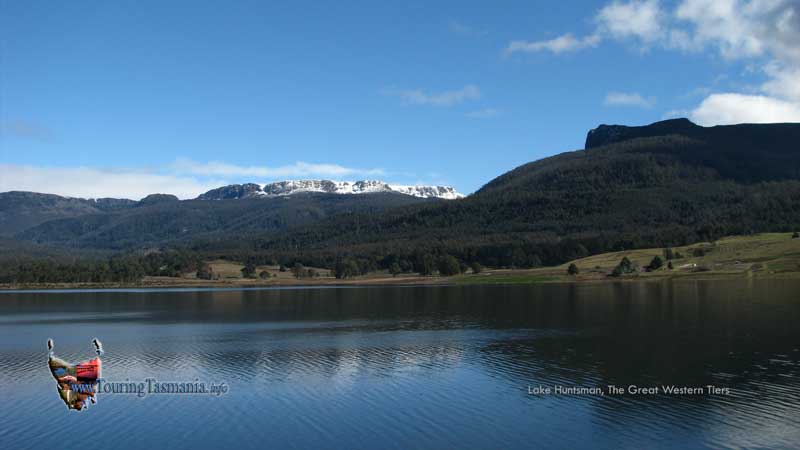
The Meander Forest Reserve
provides a backdrop for the magnificent new Lake Huntsman irrigation
dam. Snow covered Ironstone Mountain and Bastion Bluff. Mother Cummings Peak is on the right. There is a very
strong case for the area in the picture to become a National Park.
Arguably the best forest walks in Tasmania spoilt by the degradation of
the areas just outside the reserve by clearfelling. If it must be
taken, it may make more sense to replace the timber with a mixed forest
preserving the areas original look.
On
the way to Deloraine from Launceston there is a detour to Liffey
Falls. The falls can be accessed via Bracknell. Turn off
the Bass Highway about 10 kilometres west of Launceston - about a 3/4 hour
drive. There is
a well appointed reserve. A pretty rainforest drive continues up the
Tiers from Liffey and again down into the gorge. The road is very
narrow and care needs to be taken. Unfortunately there is
considerable logging in the area detracting from its beauty. Most of
the forests flanking the Tiers are essentially being clear felled. The
falls can also be accessed from Deloraine via the Lake Highway. This
is an easier drive. Further up
the Lake Hwy is Pine Lake. Only a short drive on a very good road.
Well worth the trip.
|
|


