|
MT RUFUS
NARCISSUS BAY
|
SPONSORS
accent on
 tasmania
|
follow updates on
| |
Cynthia Bay
LAKE ST CLAIR
| |
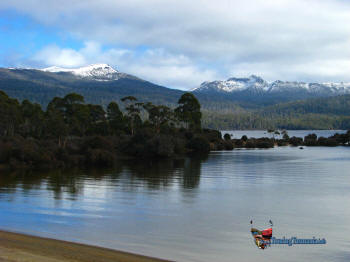
The southern end of
Lake St Clair is not as attractive as it's counterpart at the
northern end of the park - Dove Lake below Cradle Mountain.
However, there is a very picturesque short drive to Pump House Point
providing sweeping views from Mt King William to Mt Olympus and
beyond. The image on the right includes Mt Rufus on the left
and Mt Hugel on the right. The turn off is a few kilometres
south of the visitors centre. |
 |
|
| |
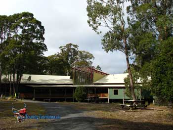
The visitors centre
at Cynthia Bay on Lake St Clair. There is a very good licenced
restraunt here. There is also ample accommodation at Lake St
Clair and at nearby Derwent Bridge.
The better walks
are at the northern end of the lake. A ferry service is
available. Mt Rufus at the southern end is a spectacular walk
but a very long day walk. |
 |
|
|


