|
|
SPONSORS
accent on
 tasmania
|
follow updates on
| |
North-West Coast
The
Far North-West, Smithton & The Tarkine
|
The Tarkine |
The
far North West can often be overlooked by visitors. The area west of
Wynyard and Burnie to the far north western tip of the island has a great
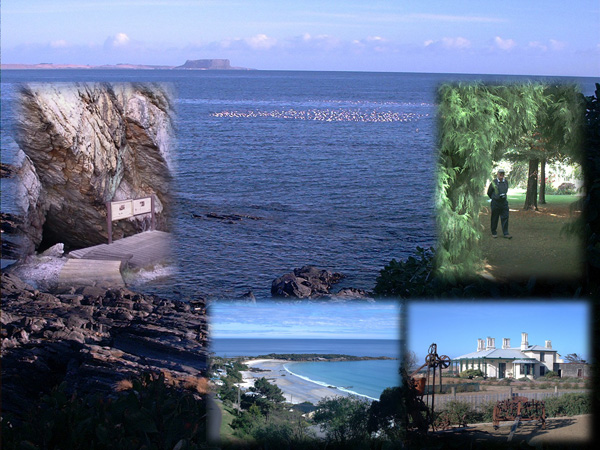
deal to offer. The costal view above depicts the unique Circular
Head - known as "The Nut". At it's base is the
historical fishing village of Stanley with a rich history to
explore. Just to the right behind the view is Rocky Cape National
Park, a scenic and historical aboriginal site. One of two small
aboriginal caves is shown to the centre left in the banner above.
The popular Boat Harbour beach is at the bottom centre. Historic
Highfield House is at the bottom right. Allendale Gardens, centre
right, just south of Smithton are a delight.
Other
attractions include a wild surf beach at Marrawah where the Bass Highway
ends. The historic Woolnorth property comprising the far north west
corner. Cape Grim is where the worlds purest air is measured.
Further south is the Arthur River. A wilderness cruise operates on
the river rivalling it's counterpart at Strahan to the Gordon River.
There are large areas of Rainforest to explore along with the drive
through the wilderness region known as the Tarkine south to Corinna on the
Pieman River.
Click on The Tarkine
for more!
|
 |
|
on the Dip Falls road near Stanley
|


