|
TASMANIA MAP GUIDE |
a pictorial guide to Tasmania's natural attractions |
|
|
|
 |


|
|
follow updates on
|
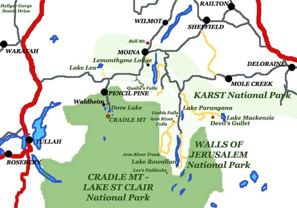
Cradle Mountain THE ROAD TO CRADLE
Most visitors to Tasmania eventually make their way to Cradle Mountain. Many make the "Overland Track" their only destination. The traditional route to Cradle is from Devonport via Forth, Wilmot and Moina. Up until only a few years ago, the road from Moina to Cradle Valley was gravel and the only way into the area. Today a very good sealed road has been built through to the Lyell Highway in the west making Cradle easily accessible from the West Coast and Burnie. Click on the 'Back Road" menu option. The road from Burnie through Hampshire is excellent allowing 100kph speed virtually all the way - although not as scenic as the Forth or Cethana Gorge routes. There are some scenic diversions including the Hellyer Gorge, the town of Waratah and Corinna on the Pieman River. The Burnie route is fairly friendly for bicyclists. Just the hill in Burnie and another at Mt Beecroft near Cradle.
|