|
MEANDER WALK
MEANDER TIERS
|
SPONSORS
accent on
 tasmania
|
follow updates on
| |
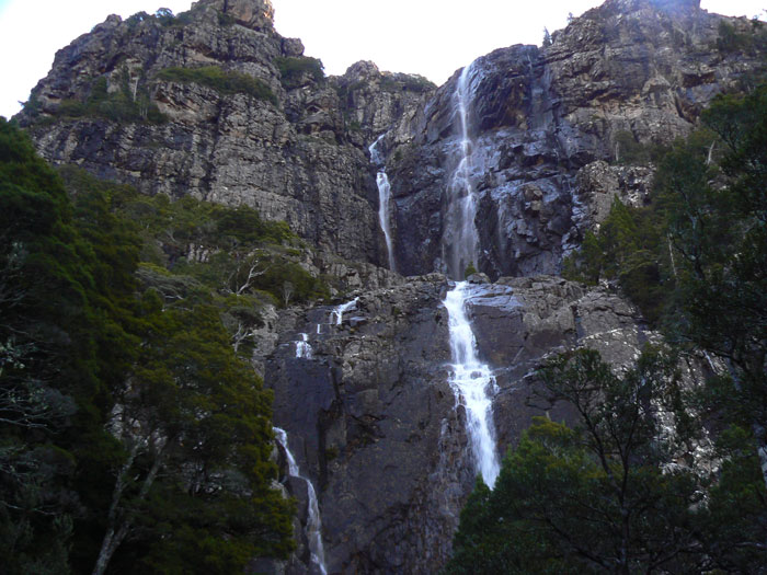
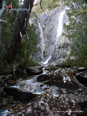
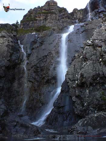
MEANDER
FALLS
The
Great Western Tiers
|

|
NOTE: 30cm of rain fell on
the slopes of The Great Western Tiers in a few hours on 14th January
2011. Several bridges and roads have been washed away. Access to Meander
Falls and Bastion Cascades has been cut off and requires a long walk
along the roads from the bridge between Smoko Road and Quarry Road. See
the
map.
THE REPLACEMENT OF THE
BRIDGES WAS COMPLETED IN DECEMBER 2015
A
comfortable 1 hours drive from Launceston or Devonport is the start of the Meander Falls
Walk. One of the Tasmanian great walks. The track is quite
rocky. As such there is little mud to negotiate. The
walk is relentlessly uphill for 3 to 3 1/2 hours. The only respite
is the last 20 minutes or so which crosses a short plateau past vast amounts of
rocky scree. The falls form two tiers as they descend through a rocky chasm.
They are especially spectacular after frosty spells in winter and spring when
sections of the falls can freeze and form huge icicles.
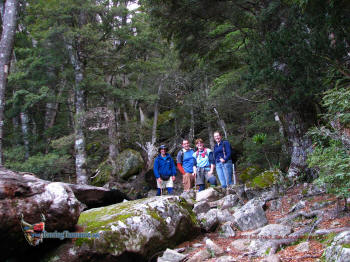
We came
across a group of Enthusiastic young walkers from Smithton, Dave,
Andrew, Nicole and Bec on the Meander Falls track. The 2nd of June 2008
on a perfect early winters day. |
 |
|
| |
 |
|
| |
 |
 |
|
The
uphill climb has its scenic benefits. Rising quickly, the vegetation
changes considerably with the altitude. For example, examples of Tree Fern
are only prevalent for the first 30 minutes of the walk. The walk follows
the Meander River virtually all the way apart for a steep section near
where the track reaches the plateau. About half an hour from the base of the
falls. You will no doubt want plenty of breaks before reaching here.
The
track passes about 50 metres east of the river and in most places high above
it. However, there are plenty of opportunities to take pictures which can
only be describes as pristine. The temptation is great to stop. It
is best to take them on the way up. The descent can be bone crunching.
|


