|
TASMANIA MAP GUIDE |
a pictorial guide to Tasmania's natural attractions |
|
|
|
 |


|
|
follow updates on
|
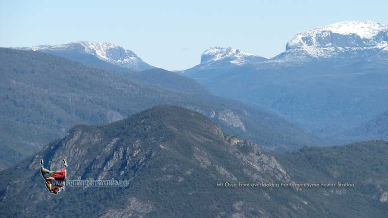
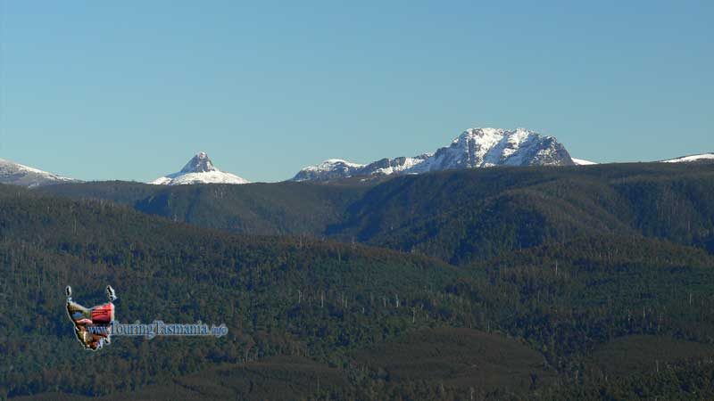
The Lemonthyme The Road to Cradle
An alternative route from Launceston to Cradle Mountain is through Deloraine, Mole Creek and south of Mount Roland. Behind the mountain is a short diversion to the Lemonthyme power station. Before the road descends into the gorge, there is an excellent view of the Fourth River valley with Cradle Mountain National Park in the background. The larger mountain on the right (above) is Mt Ossa, Tasmania's tallest mountain. The image below shows the distinctive pointed shape of Barn Bluff on the left with Cradle Mountain to the right. Lemonthyme Lodge is in the valley further off to the right. Access is through the Cethana Gorge - about another 3/4 hours drive..
|