|
|
SPONSORS
accent on
 tasmania
|
follow updates on
| |
Julius River Caves
The South Arthur Forests -
The Tarkine
|
|
A couple of kilometres past the The Julius
River Forest Reserve picnic area is the Sumac 2 Spur road which heads
off to the left. 1.5 and
1.7 kilometres along the road are two taped bushes on the left
indicating the start of walking tracks.
(UPDATE: The road beyond the first access track was overgrown when we
visited in October 2017) The tracks lead to
the very unknown Julius River Caves. The tracks both meet about
half way to the caves. They are very well marked. The first
track passes a dry sink hole before descending very steeply to a creek
crossing. Shortly after crossing the creek the second track is
encountered.
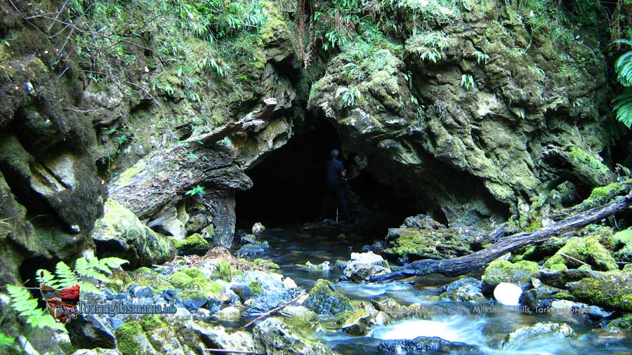
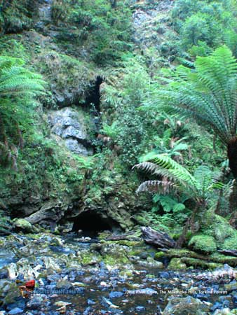
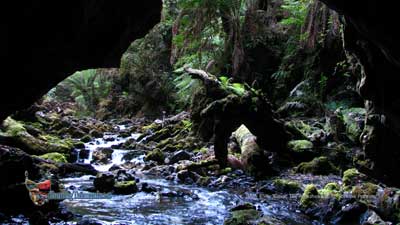
The caves are another 15 minutes walk past
the track junction. The main cave is shown on the right. A
most interesting section of the river is worth exploring upstream from
the cave. There is an arch, a short cave, a cave ledge and a small
waterfall all within 300 metres of the main cave.
The walk in is a little more than 30
minutes on either track. The road is quite suitable for 2 wheel
drive vehicles but the undergrowth is likely to scratch you vehicle.
There was only just enough room to turn around when we visited in 2017.
WARNING: The track
requires the wading of 2 creeks and may be impassable after heavy rain.
The river passes through a small
gorge and would no doubt back up behind the cave after heavy rain. |
 |
|
| |
|
|
| |
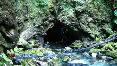
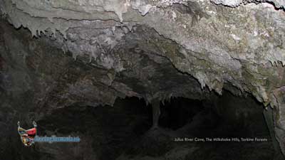
Looking into Julius River Cave #2 |
|
|
| |
 |
View from inside the cave. |
|
| |
 |
Stalactites on a ledge overlooking the
arch further upstream. A short 10 minute walk. |
|
|